


Description
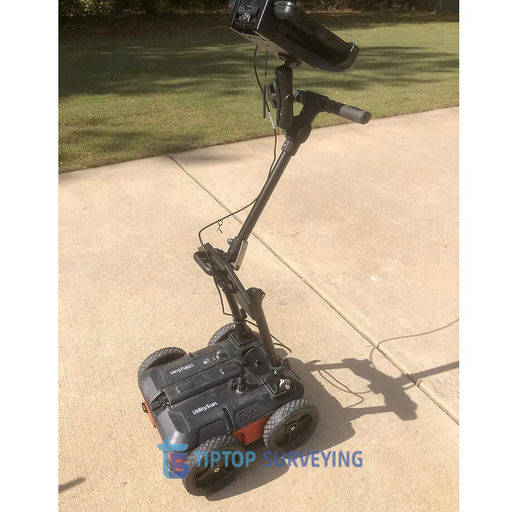
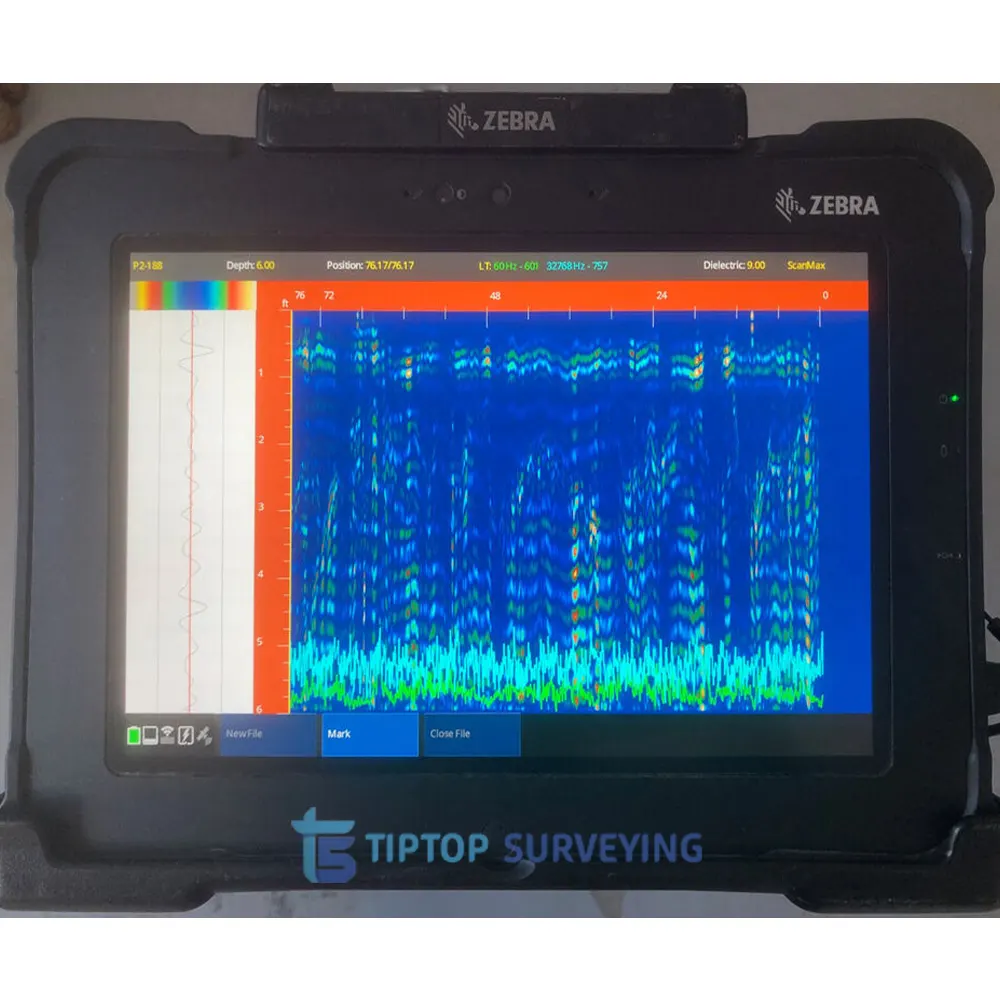
We are selling pre-owned GSSI UtilityScan GPR System complete kit, excellent working condition, comes with RADAN 7 software. This GSSI UtilityScan GPR System Optimized for UtilityScan is ideal for marking the location and depth of subsurface utilities, including gas, sewer, and communication lines. Real-time target mapping features include a new Map Mode that allows users to trace their steps and gain a bird’s-eye view of their survey. Users can also simultaneously place APWA color-coded marks on 2D data and a geo-referenced map.
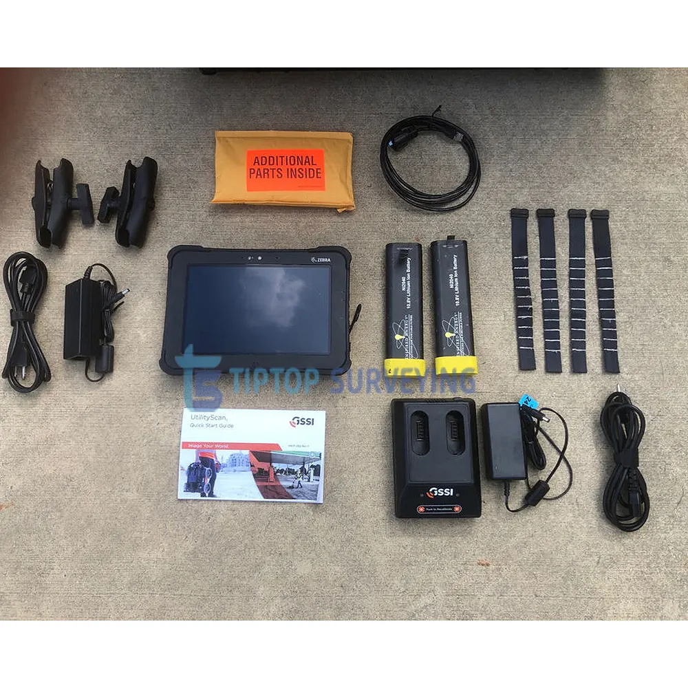
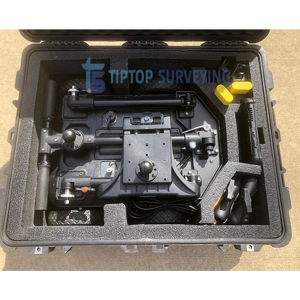
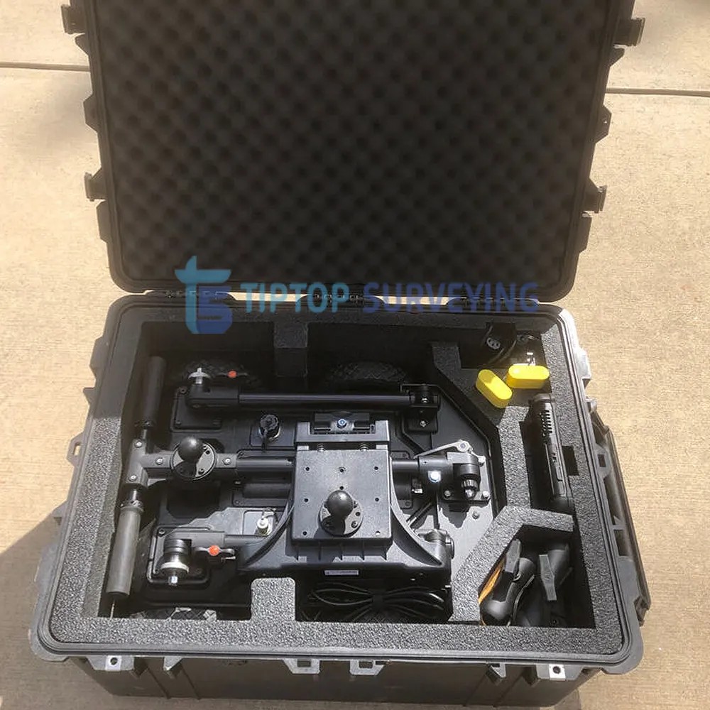
GSSI UtilityScan GPR System Set what’s includes:
- GSSI UtilityScan GPR System
- Rugged Zebra Tablet
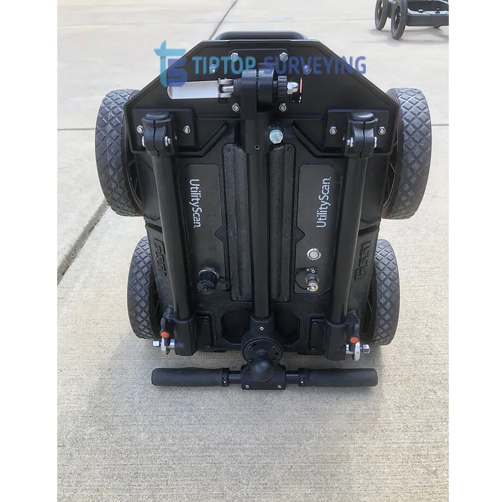
- 350 MHz Hyper Stacking antenna
- Integrated LineTrac accessory
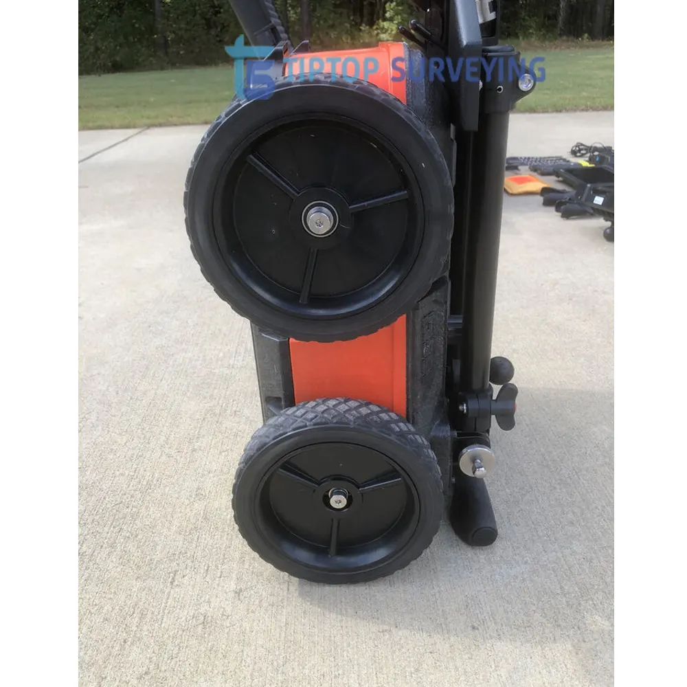
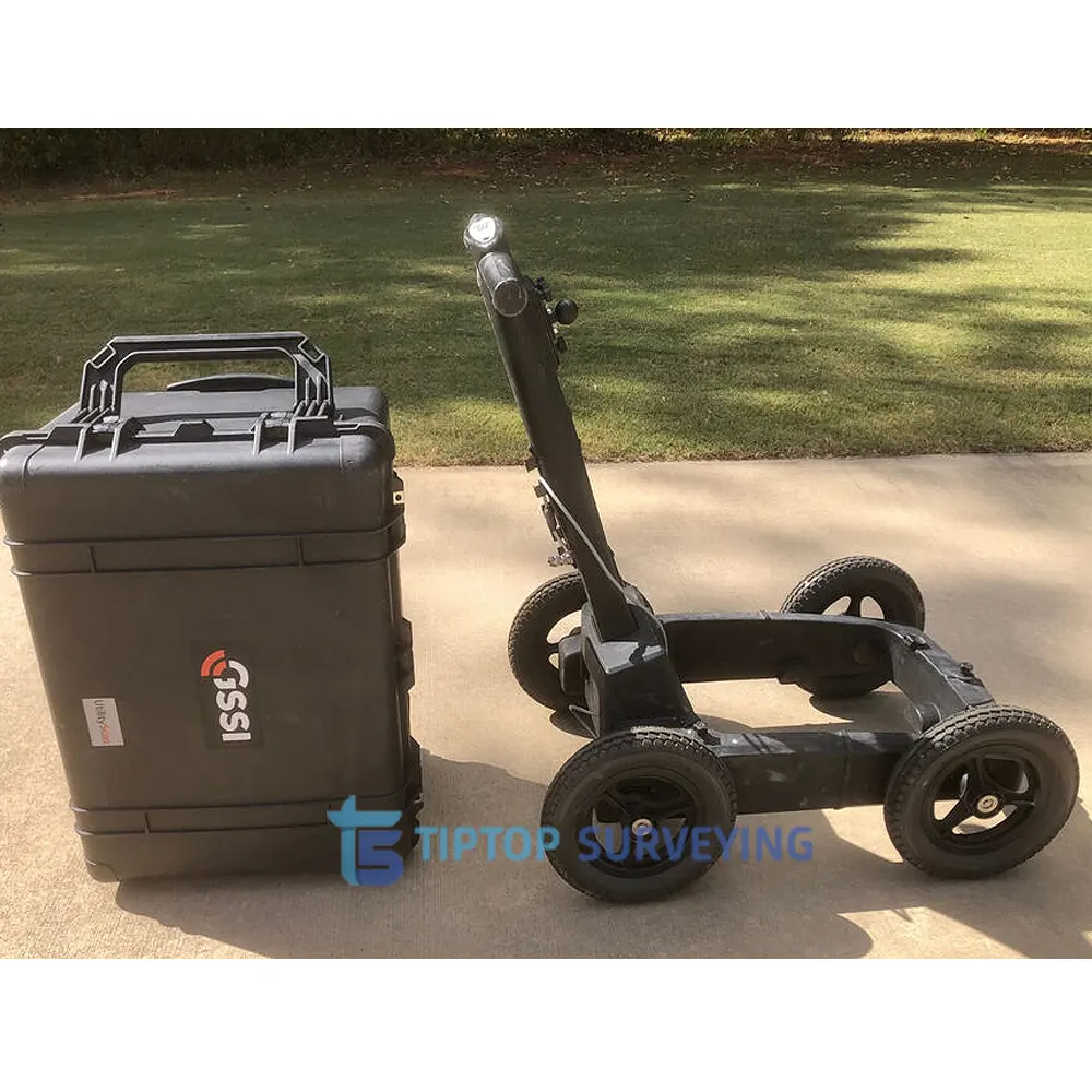
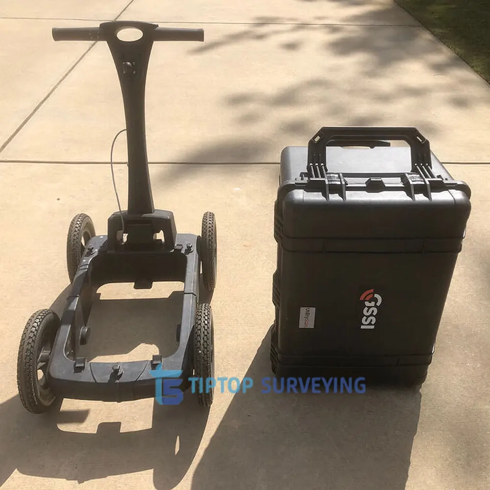
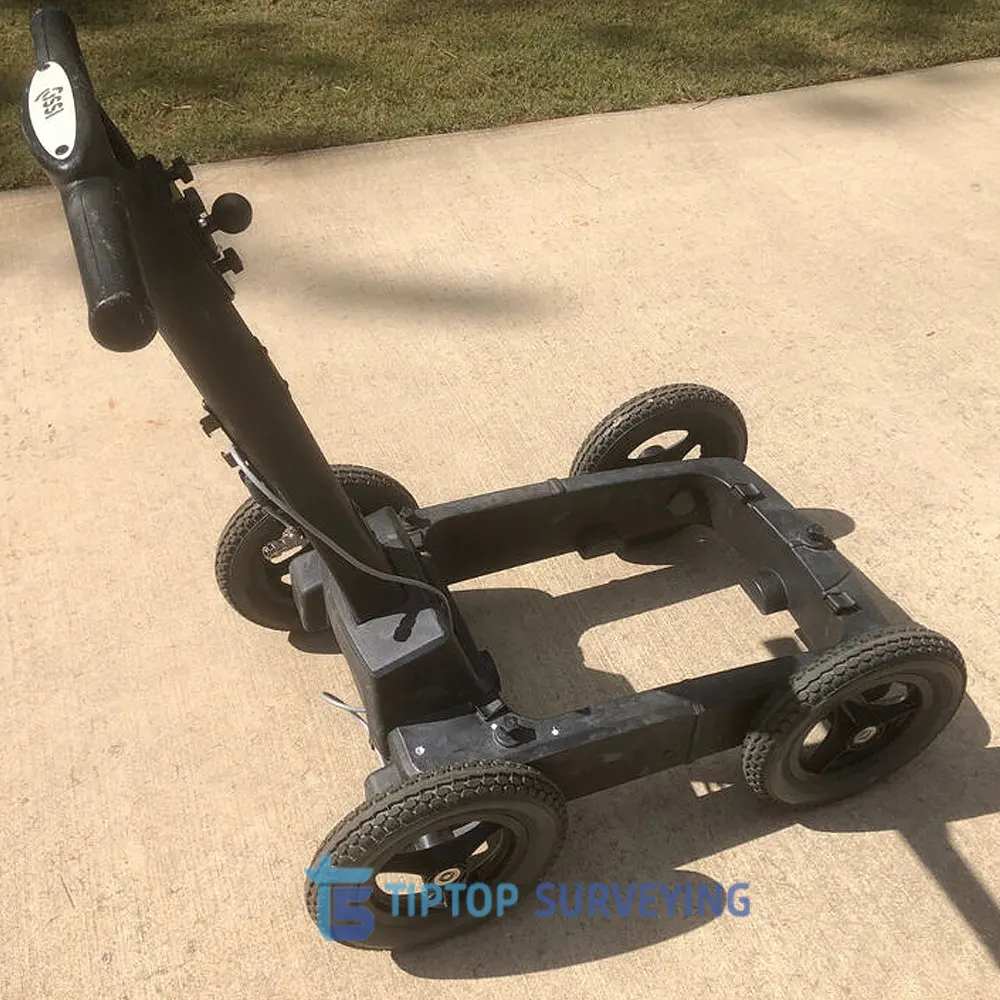
- Integrated cart
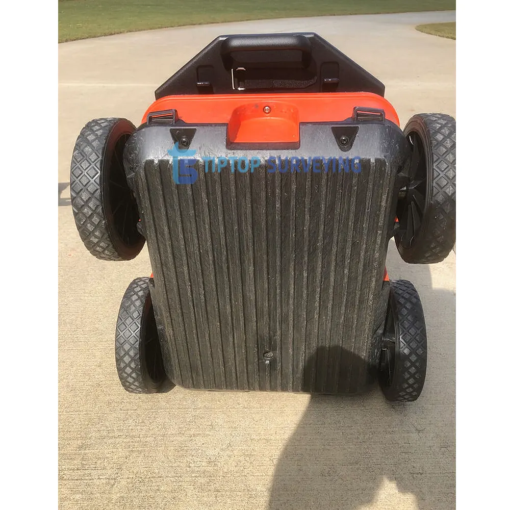
- Additional Rugged Four-Wheel Cart
- (2) Lithium-ion batteries
- Dual-bay battery charger
- Quick Start Guide
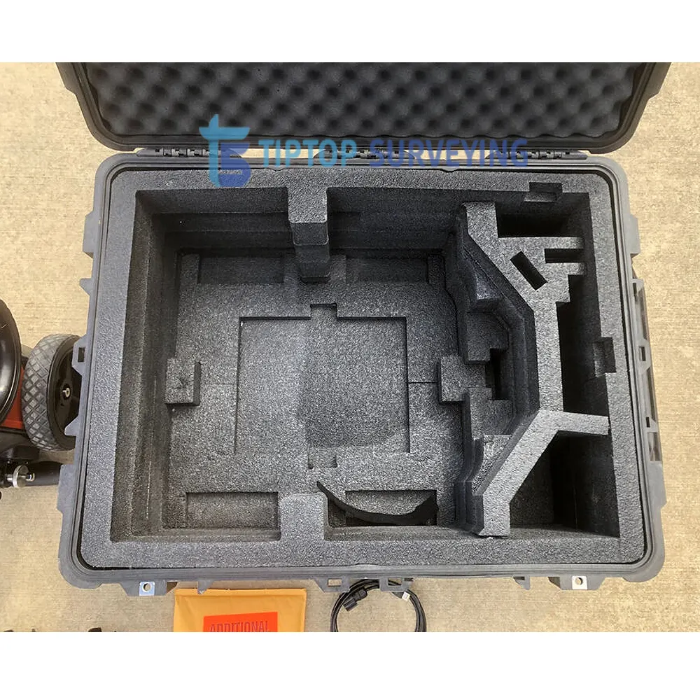
- Transit Case
- Additional cables and mounting hardware
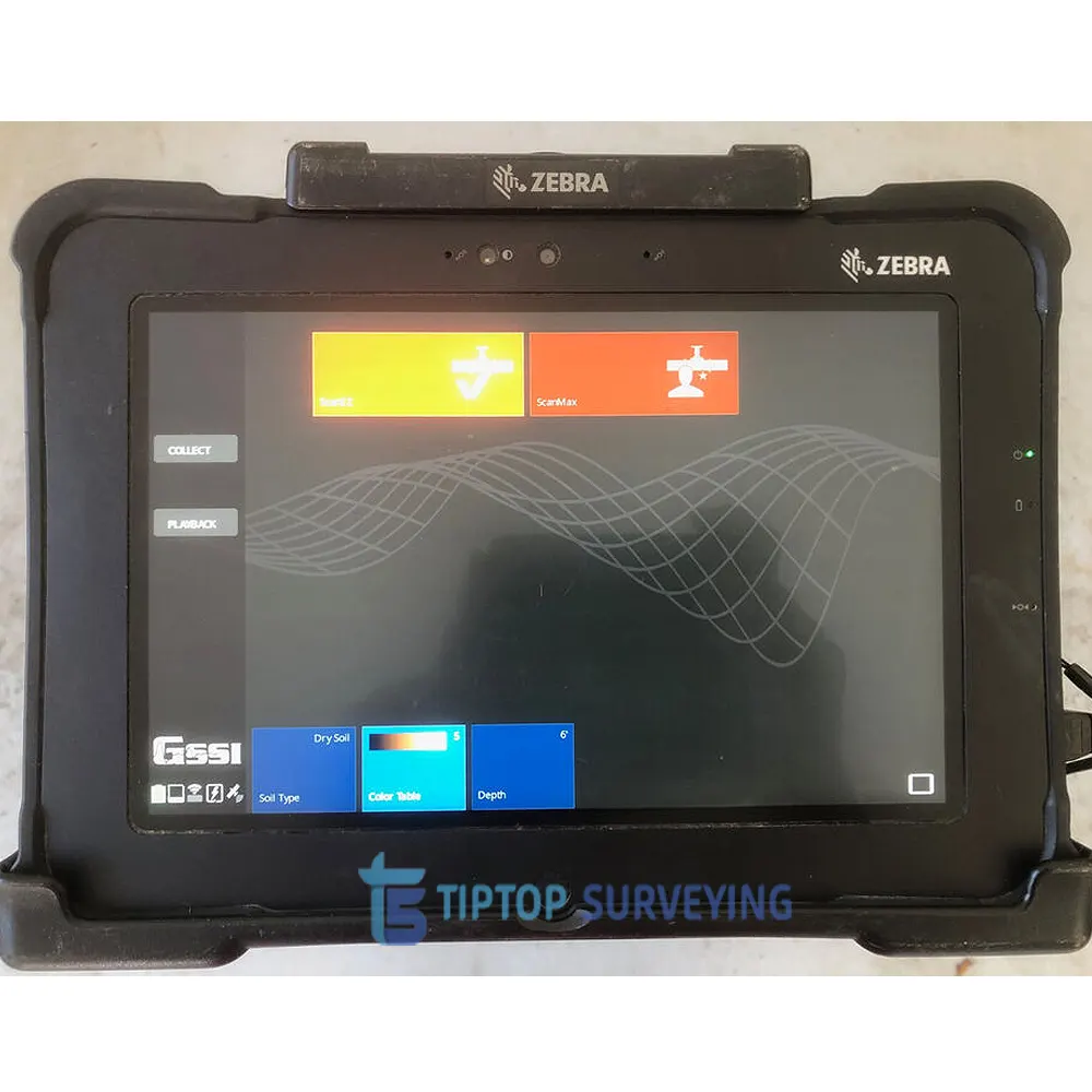
With the updated UI, users can collect and create 3D scans. The on-screen 3D data collection mode allows users to easily define the time slice depth and thickness in the field with the 3D data on the screen. The map window can be minimized to view the 3D display full screen. The rugged, flexible system is rated IP65, with durable components tested to withstand the most challenging survey environments, including rain, dust, and freezing down to 4°F. The integrated Panasonic G2 tablet screen is designed for rain and glove use. For areas where Wi-Fi is prohibited, the system includes a rugged Ethernet cable that can be used for communication between the tablet and antenna.
GSSI UtilityScan GPR System is available with the optional LineTrac power detection module, which enables identification and tracing of the precise location of underground electric and RF-induced utilities. This allows the detected power or induced frequencies data to be overlaid on the radar data, providing reliable positioning and target information. This system is compact and portable, only weighing 16.8kg.
Data Example:
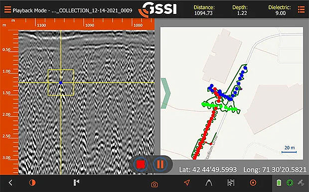
Map Mode
With Map Mode on UtilityScan, you can simultaneously pick targets and view their corresponding location on the GIS map shown on the right side of the screen. You can select the window size of the data and the map, or keep it split evenly as shown. The map in this data example shows on overview where the user located their different types of utilities. The dark green line represents the path that was taken when collecting the data.
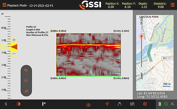
3D Image
On-screen 3D data collection mode are allows you to define an area of interest. You can easily define the time slice depth and thickness in the field with the 3D data on the screen. The map window can be minimized to view your 3D display full screen.
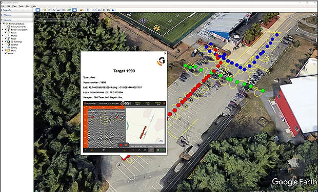
Satellite and Aerial Imagery
GSSI UlilityScan software automatically saves a sample image (Target 1990 in this example) for every target designates within the software. These in-field targets can easily be exported into commonly available geo-browsers. These browsers can be used images for report in the office or in the field.
Quick Specifications:
- Max Depth: 10 m (35 ft)
- Antenna Frequency: 350 MHz
- Weight with Tablet & Battery: 16.8 kg (37 lbs)
- Storage Capacity: 512 GB
- Optional Software: RADAN 7 for UtilityScan, RADAN 7
- Accessories: Geode GPS, Transit case, Model 626 survey cart, Model 656 survey cart
GSSI UtilityScan GPR System Set is typically used to:
- Scan utilities – metallic and non-metallic
- Locate water lines
- Detect voids and underground storage tanks (USTs)
- Identify soil and foundation characteristics
- Locate shallow objects for archaeology
