10,000.00USD
● InStock
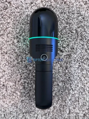
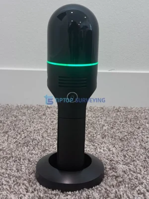
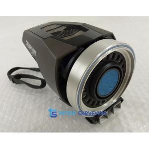
Using SLAM (Simultaneous Localization and Mapping) technology, the BLK2GO automatically tracks its position and orientation while scanning, allowing users to capture complex indoor and outdoor environments without the need for tripods, targets, or GPS. The scanner combines dual-axis LiDAR sensors, panoramic imaging cameras, and visual inertial systems to produce detailed colorized point clouds ready for processing and modeling.
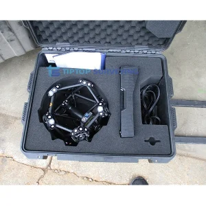
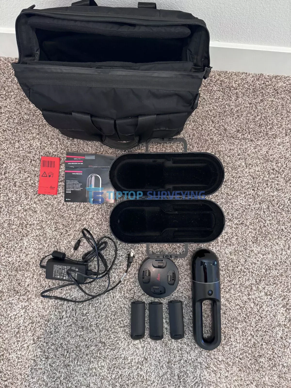
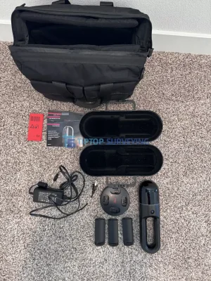
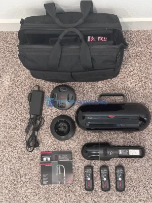
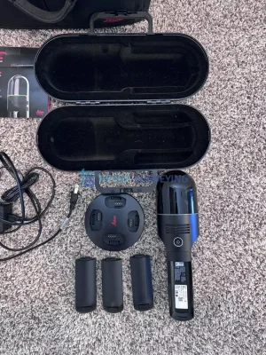
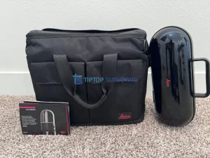
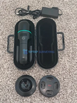
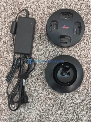
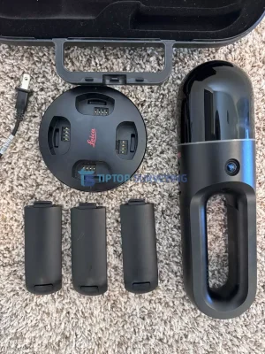
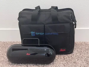
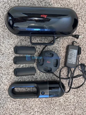
This used Leica BLK2GO scanner is offered in good working condition and comes as a complete kit, making it ideal for professionals in surveying, architecture, construction, engineering, facility management, and BIM workflows. The system integrates seamlessly with Leica’s Cyclone software ecosystem, enabling users to transform captured data into accurate 3D models, digital twins, and documentation.
The BLK2GO is designed to dramatically reduce the time required for field data collection, allowing professionals to scan buildings, infrastructure, and environments quickly and efficiently.
| Specification | Details |
|---|---|
| Model | Leica BLK2GO |
| Scanner Type | Handheld Mobile Imaging Laser Scanner |
| Scanning Technology | LiDAR with SLAM |
| Point Capture Rate | Up to ~420,000 points per second |
| LiDAR Sensor | Dual-axis LiDAR |
| Imaging System | 6-camera panoramic imaging |
| Data Capture | Colorized point clouds |
| Position Tracking | Visual Inertial SLAM |
| Maximum Range | Up to ~25 meters |
| Accuracy | Approx. 6–15 mm depending on environment |
| Storage | Internal SSD storage |
| Connectivity | Wi-Fi, USB |
| Battery | Rechargeable lithium-ion |
| Battery Runtime | Approx. 45 minutes per battery |
| Weight | Approx. 775 g |
| Dimensions | Approx. 279 × 80 × 90 mm |
| Operating Temperature | 0°C to 40°C |
| Software Compatibility | Leica Cyclone REGISTER 360, Cyclone FIELD 360 |
Similar equipment from the same category.