
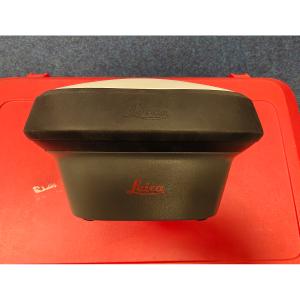
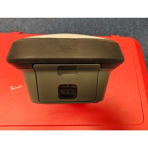
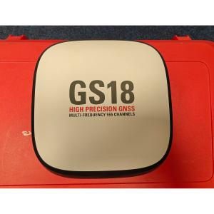
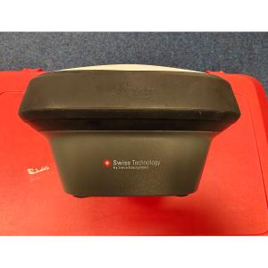
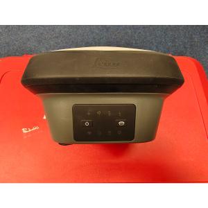
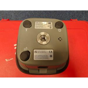
Leica GS18 T GNSS Rover Set
- Brand: Leica Geosystems
- Category: GNSS Smart Antenna
- Condition: UsedCondition
- Warranty: 6 Months
Request Quote
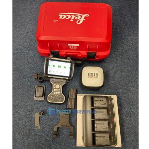
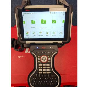
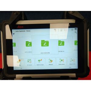
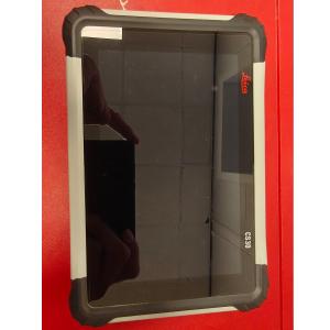
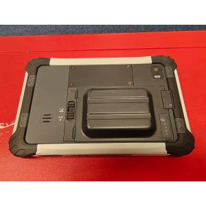
Leica GS18 T GNSS Rover with Leica CS30 Rugged Field Controller
Used Excellent Condition (Manufactured 2024) | Complete Professional Surveying Set
The Leica GS18 T GNSS Rover combined with the Leica CS30 Rugged Field Controller represents one of Leica Geosystems’ most advanced and reliable GNSS surveying solutions. This used unit is offered in excellent condition, has been carefully maintained, fully tested, and is ready for immediate deployment in demanding professional environments.
Engineered for surveyors, construction professionals, and geospatial specialists, the GS18 T features IMU-based tilt compensation, allowing accurate measurements without the need to level the pole—dramatically increasing productivity and efficiency in the field. Paired with the powerful and intuitive Leica CS30, this complete set delivers seamless data capture, robust performance, and trusted Leica precision.
This system is ideal for land surveying, construction layout, infrastructure projects, mapping, and topographic surveys, offering survey-grade RTK accuracy even in challenging environments such as urban canyons or obstructed sites. As a complete set, this package provides everything required to begin work immediately, making it a cost-effective alternative to purchasing new equipment without compromising performance or reliability.
Included in the Sale:
- Leica GS18 T Smart Antenna
- Leica CS30 Rugged Field Controller
- Leica GKP Bluetooth Keyboard
- Multi-Battery Charging Dock with Four Leica GEB Batteries
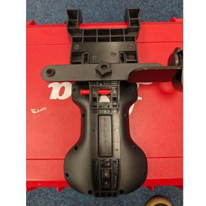
- Leica Quick-Release Pole Bracket
- Leica Transport Hard Case
- Charging Cable and UK Power Supply
Key Highlights
- Demo / used unit in excellent working and cosmetic condition
- Survey-grade RTK GNSS accuracy
- Advanced IMU tilt compensation for measurements without leveling
- Proven Leica GNSS smart antenna technology
- Rugged Leica CS30 field controller for harsh environments
- Fully tested and verified for professional use
- Ideal for surveying, construction, and geospatial applications
- Complete set ready for immediate field operation
Typical Applications
- Land and boundary surveying
- Construction layout and control
- Infrastructure and civil engineering projects
- Mapping and GIS data collection
- Topographic and site surveys
Leica GS18 T GNSS Smart Antenna
| Specification | Details |
|---|---|
| GNSS Technology | Multi-constellation GNSS (GPS, GLONASS, Galileo, BeiDou, QZSS) |
| Positioning Method | RTK, Network RTK, Static |
| Accuracy (RTK) | Horizontal: ±8 mm + 1 ppm Vertical: ±15 mm + 1 ppm |
| Tilt Compensation | IMU-based, calibration-free |
| Tilt Angle | Up to 30° |
| Initialization Time | Typically < 10 seconds |
| Data Logging | Internal memory |
| Communication | Bluetooth, WLAN, UHF (model dependent) |
| Battery Type | Internal, hot-swappable |
| Operating Time | Up to a full working day (depending on usage) |
| Environmental Rating | IP68 |
| Operating Temperature | −40°C to +65°C |
Leica CS30 Rugged Field Controller
| Specification | Details |
|---|---|
| Operating System | Windows® Embedded Handheld |
| Display | 5-inch color touchscreen |
| Protection Rating | IP68 |
| Processor | High-performance industrial CPU |
| Connectivity | Bluetooth, WLAN, USB |
| GNSS Integration | Optimized for Leica GNSS systems |
| Battery | Hot-swappable Li-ion |
| Operating Temperature | −30°C to +60°C |
| Field Software Compatibility | Leica Captivate |