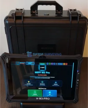
Counter Surveillance MEFF M3-PRO Professional Malware Spyware Scanner ★★★★☆ (5) 8,000.00USD ● InStock View Specifications
Digital Measuring Devices Leica iCON iCS50 Robotic Construction Sensor ★★★★★ (10) 13,400.00USD ● InStock View Specifications
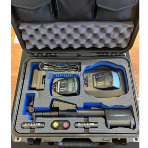
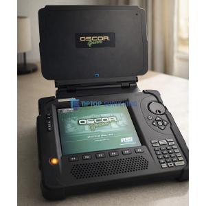
(TSCM) Equipment REI Orion HX Deluxe 2.4 Twin Head NLJD ★★★★★ (15) 11,800.00USD ● InStock View Specifications
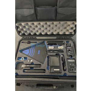
Analyzer REI ANDRE Deluxe Near-field Detection Receiver ★★★★★ (5) 3,800.00USD ● InStock View Specifications
Ground Penetrating Radar GSSI Profiler EMP-400 EM Instrument ★★★★☆ (8) 3,500.00USD ● InStock View Specifications
Phased Array Ultrasonic Testing (PAUT) OmniScan X4 phased array flaw detector ★★★★★ (5) 14,300.00USD ● InStock View Specifications